
Survey control
In land and engineering surveying the survey control and error analysis is the most important activity that the surveyor undertakes.
This framework of survey stations whose co-ordinates have been precisely determined and are (usually) considered definitive. These stations are the references that all other survey work is related. A control network needs to be precise, complete and reliable and it must be possible to show that these qualities have been achieved.
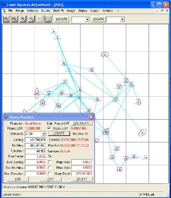
However, in the real world all observations / measurements contain error. This is due to the equipment used and the ability of the observer. To manage the limitations of both the equipment and the observer Findlay Surveys has developed it own least squares adjustment, error propagation and analysis computer software to ensure that all the survey control networks, surveys and setting-out are precise and accurate. The error analysis confirms that the quality of the survey control network meets the specified tolerances and any subsequent survey activities can be undertaken with confidence this analysis can be delivered to the client as a stand-alone document or embedded into a drawing as text.
A control network can be made of observations with GPS (Global Positioning System) or by traditional methods (horizontal / vertical angles and distances) or a combination of both. The later is becoming more frequent as the relative cost for GPS receivers decreases and the specification to work in Ordnance Survey grid and datum becomes more common. This introduces a distance scale factor into the control network and if not understood or taken into account this could result in expensive mistakes such as incorrect boundaries or the construction in the wrong place.
See our examples page and contact us for your individual requirements. (Home)